
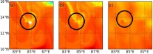
The Bay of Bengal's high-resolution sea surface salinity has been reconstructed using a Lagrangian technique leveraging satellite data. The primary input datasets utilized are sea surface salinity data from the SMAP mission and sea surface currents derived from altimetry. These datasets are obtained at a spatial resolution of 25 km. The SMAP mission has been operational since 2015, whereas altimetry-derived sea surface currents have been available since 1993. Validation of this reconstructed product was conducted against in-situ datasets obtained from thermo-salinographs. Results indicate that the reconstructed product more accurately captures front formation compared to the original SMAP salinity fields.
Data Access
Science products are available to download with a Single Sign On on MOSDAC. Click Here to access the data
Data Version
- Version 1.0 (beta).
Data Sources
- SMAP Sea Surface Salinity (https://podaac.jpl.nasa.gov/dataset/SMAP_JPL_L3_SSS_CAP_8DAY-RUNNINGMEA…) Altimetry-derived sea surface currents (https://data.marine.copernicus.eu/product/SEALEVEL_GLO_PHY_L4_MY_008_04…).
Processing Steps
- i. Remap Sea Surface Currents with a spatial resolution of 5 km.
- ii. Backward advection of particles from the final time {t} rsub {f} to the initial time {t} rsub {f} -14 , where 14 is the number of days the particles are advected using Runge-Kutta 4th order method.
- iii. The SMAP Sea Surface Salinity observed at {t} rsub {f} -14 is interpolated onto the particle positions that day.
- iv. With this, each particle has an SSS value on {t} rsub {f} day that corresponds to the observation at {t} rsub {f} -14 .
References
- [1] Barbara, B., Drushka, K., & Gaube, P. (2021), “Lagrangian reconstruction to extract small-scale salinity variability from SMAP obervations”, JGR Oceans, 126(3), e2020JC016477.
- [2] Dencausse, G., Morrow, R., Rogé, M., and Fleury, S. (2014). Lateral stirring of large-scale tracer fields by altimetry. Ocean Dynamics, 64(1), 61–78.
- [3] Desprès, A., Reverdin, G., and d'Ovidio, F. (2011). Mechanisms and spatial variability of mesoscale frontogenesis in the northwestern subpolar gyre. Ocean Modelling, 39(1), 97–113.
- [4] Durack, P. J., Lee, T., Vinogradova, N. T., and Stammer, D. (2016). Keeping the lights on for global ocean salinity observation. Nature Climate Change, 6(3), 228–231.
- [5] Lehahn, Y., d'Ovidio, F., and Koren, I. (2018). A satellite-based Lagrangian view on phytoplankton dynamics. Annual Review of Marine Science, 10(1), 99–119.
- [6] Rogé, M., Morrow, R. A., and Dencausse, G. (2015). Altimetric Lagrangian advection to reconstruct Pacific Ocean fine-scale surface tracer fields. Ocean Dynamics, 65(9), 1249–1268.
Derivation Techniques and Algorithm
- The algorithm is called Lagrangian Reconstruction Technique. User should refer [1].
Limitations
- This algorithm is applicable only in the region with moderate to high eddy kinetic energy and where lateral advection dominates.
High resolution sea surface salinity product generated by Lagrangian technique can have error due to tracer bias (depends on accuracy of initial conditions) and advection bias (Passive stirring can introduce bias due to mixing physics (air-sea fluxes, mixing etc.)).
Known problems with data
- Data sets have biases as well as inaccuracy.
File Naming Convention
- Netcdf file: HRSSS_bck_YYYYMMDD_14D.nc
| Sr.No | Core Metadata Elements | Definition |
| 1 | Metadata language | English |
| 2 | Metadata Contact | MOSDAC |
| 3 | Metadata date | April, 2015 |
| 4 | Data Lineage or Quality | High resolution sea surface salinity in Bay of Bengal using Lagrangian technique. |
| 5 | Title | Dynamic downscaling of Satellite Sea Surface Salinity for the Bay of Bengal |
| 6 | Abstract | Lagrangian technique is used for generating high-resolution sea surface salinity fields in the Bay of Bengal. This is achieved through the utilization of Sea Surface Salinity (SSS) data derived from the Soil Moisture Active Passive (SMAP) satellite, in conjunction with sea surface currents obtained from altimetry. By employing forward and backward schemes for the numerical advection of SMAP SSS fields using altimeter-derived geostrophic currents, a Lagrangian reconstruction is produced, capturing smaller-scale features. The reliability of our in-house developed algorithm is assessed by comparing it with an available reconstructed product in the Gulf Stream. Additionally, a preliminary validation is conducted against insitu data obtained from a thermo-salinograph. Further, the developed algorithm was modified to select the advection time dynamically. |
| 7 | Dataset Contact | Jai Kumar, POD/AOSG/EPSA, Space Applications Centre (ISRO), Ahmedabad, 380015, kumarj@sac.isro.gov.in |
| 8 | Update Frequency | Six months. |
| 9 | Access Rights or Restriction | Open Access |
| 10 | Spatial Resolution | Spatial resolution is 10 km |
| 11 | Language | English |
| 12 | Topic Category | High resolution sea surface salinity product (SAC-TDP) using satellite data. |
| 13 | Keywords | Sea surface salinity, sea surface currents, Lagrangian advection technique, high resolution |
| 14 | Date or period | April 2015 - June 2023 |
| 15 | Responsible Party | Jai Kumar, POD/AOGG/ EPSA, Space Applications Centre (ISRO), Ahmedabad-380015, India |
| 16 | Organization | Space Applications Centre (ISRO), Ahmedabad, India |
| 16a | Org. role | Geophysical parameters from satellite data in the Bay of Bengal region. |
| 16b | Individual name | Jai Kumar, POD/AOSG/EPSA, SAC (ISRO), Ahmedabad-380015, India. Ph: +91 79 2691 6104. Email: kumarj@sac.isro.gov.in |
| 16c | Position | Scientist/Engineer, POD/AOSG/EPSA, SAC (ISRO), Ahmedabad-380015 |
| 16d | Vertical Extent (minimumValue, maximumValue, unitOfMeasure, vertical datum) | Lat_min : 0N, Lat_max : 25N, Lon_min: 78E, Lon_max: 100 E |
| 17 | Geographic Extent | Indian Landmass |
| 18 | Geographic name, geographic Identifier | Bay of Bengal |
| 19 | Bounding box | Lat_min : 0N, Lat_max : 25 N, Lon_min: 78E, Lon_max: 100 E |
| 20 | Temporal Extent | April 2015-June 2023 |
| 21 | Access Rights or Restrictions | Open Access |
| 22 | Distribution Information | Online download of data files in netCDF format |
| 23 | Processing Level | Level 4 |
| 24 | Reference System | Datum: WGS84 |